Computer Analyzed Surface Map Help
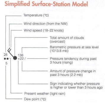
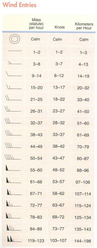
Wind Direction: The observed wind speed and direction are represented on the map by a combination of a wind shaft and wind barbs around the station model. The "wind arrow" is a symbol of the back portion of an arrow which "flies with the wind", such that the wind barbs located on the tail of the arrow are upwind, while the small circle at the head of the arrow is located at the station. Thus, the orientation of these wind arrows on the map indicates the wind direction to the nearest 10 degrees, measured clockwise from true north (top of the chart). By convention, the winds are named for the direction from which they are blowing. Hence, a south wind is from the south.
Barometric Pressure
To interpret the pressure reading:
- If the first digit of the three numbers is less than 5, put a 10 in front of the pressure reading. Also put a decimal point before the last digit. In the example above on the left, 116 would be read as 1011.6 mb.
- If the first digit of the three numbers is greater than 5, put a 9 in front of the pressure reading. Put a decimal point before the last digit. For the station on the right in the above example, the pressure would be 999.1 mb.